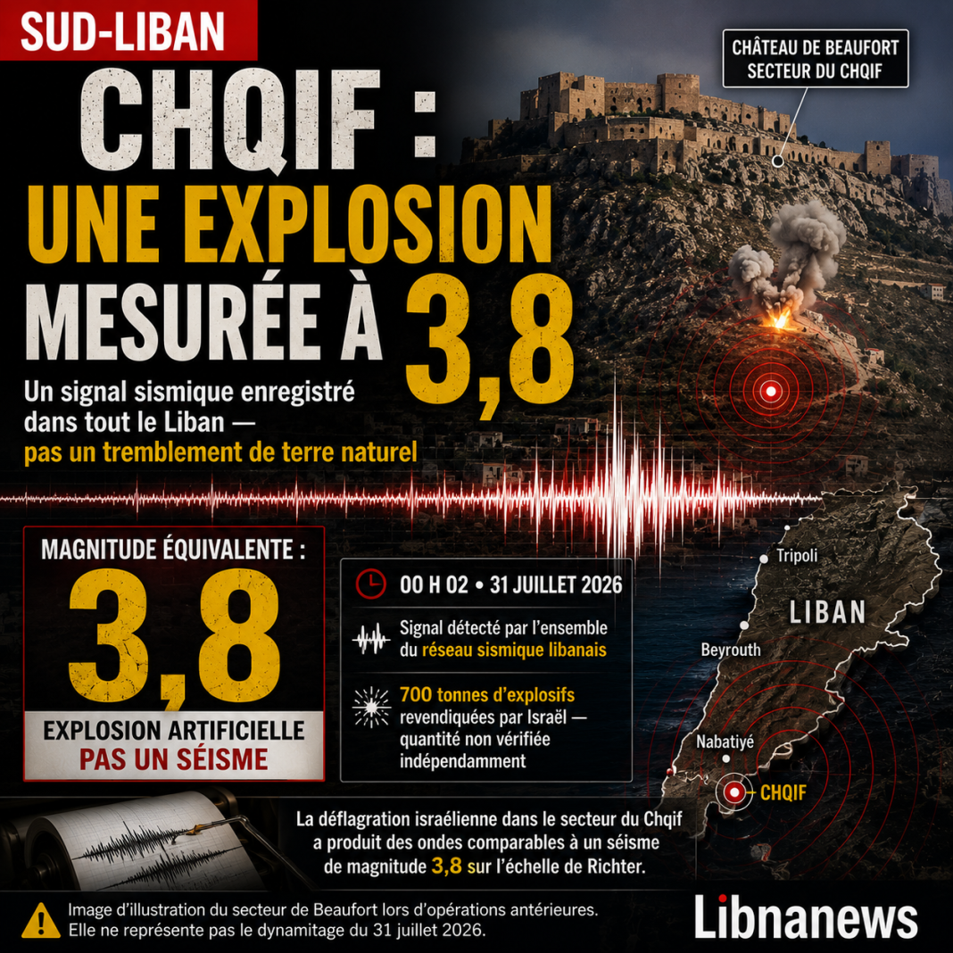






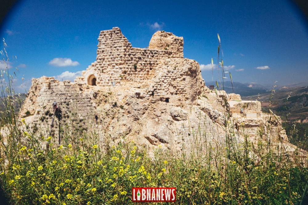
The Israeli blasting in the Shiqif region of southern Lebanon produced a signal on 31 July 2026 comparable to a tremor of magnitude 3.8. This value exceeds the magnitudes of 3.3 to 3.6 published after the explosion of the port of Beirut in 2020. However, it does not prove that the explosion of the Chqif released more total energy. Nor does it measure the damage inflicted on Beaufort Castle, located on the nearby ridge. The Lebanese Ministry of Culture indicated during the day that the fortress had not been destroyed. However, he admitted that the vibrations could have caused further damage to his environment. Direct expertise remains impossible as long as the site remains inaccessible. The verdict must therefore distinguish three facts: the seismic signal of the Chqif appears to be higher than that of Beirut, the 700 tonnes claimed are not comparable to the estimated 600 tonnes of TNT at the port, and the actual state of Beaufort remains to be established.
Affirmation considered:« The Chqif explosion was more powerful than the Beirut explosion and destroyed Beaufort Castle. »
Verdict:deceptive about power and false about the destruction of the castle. The signal transmitted to the ground is nominally higher. Total explosive yield remains unknown. Beaufort is still standing, but he had already suffered damage before July 31 and further damage cannot be excluded.
What magnitude 3.8 makes it possible to affirm
The National Geophysical Centre located the event at 0002 hours. He indicated that all of his stations had recorded terrestrial waves related to blasting. His statement does not describe a tectonic earthquake. It compares the observed signal with that of a tremor of magnitude 3.8. This precision is essential. A seismometer measures a movement of the ground. It can record a failure, explosion, cavities collapse or industrial activity.
The magnitude summarizes the instrumental size of the source from the received waves. It does not deliver directly the mass of explosives. Nor does it measure the excess pressure in the air, heat, projections or extent of destruction. For the Shqif, the figure of 3.8 shows above all that the operation transmitted a significant amount of energy to the rock massif. The underground containment announced by Israel can explain this high signature.
The fact that all Lebanese stations captured the event does not mean that the same intensity was felt everywhere. The instruments detect very weak movements. Local effects depend on distance, terrain, nature of rocks and the vulnerability of buildings. National value therefore does not replace a village inspection or a fortress expertise.
A higher signal than Beirut
The explosion of the port of Beirut had received several values according to networks and methods. An American scientific institution had published a magnitude of 3.3. Regional analyses used figures of up to 3.6. The difference with the Chqif thus reaches 0.2 to 0.5 point.
On the same local scale, a 0.2 difference is about 1.58 times greater. A difference of 0.5 corresponds to an amplitude approximately 3.16 times greater. The conventional relationship used for earthquakes would also yield a seismic energy ratio close to two between 3.8 and 3.6, then about 5.6 between 3.8 and 3.3.
These calculations do not rank explosive yields. First, they assume that the magnitudes are strictly comparable. The exact type of magnitude chosen for the Shqif, its margin of error and the parameters of the calculation have not yet been published. They then describe the component passed into the ground. They do not measure all chemical energy released.
Beirut: Why the 600-ton mark holds
The explosion of 4 August 2020 is generally estimated around 600 tonnes of equivalent TNT. This number does not correspond to the 2,750 tonnes of ammonium nitrate reported in Hangar 12. It represents an energy rebuilt from the observed effects. A load of 600 tons of TNT would release about 2.5 terajoules.
Several teams used separate methods. An analysis of fireball expansion proposed about 0.6 kilotonnes, with an uncertainty of 0.3 kilotonnes. A study of the time of arrival of breath on videos obtained 637 tons, with a range of 407 to 936 tons. Other work included a better estimate of 500 tonnes and a reasonable high limit of 1,120 tonnes.
An analysis combining seismology, infrasounds, hydroacoustic signals and satellite images produced a much wider range. This dispersion reflects the complexity of the event. An explosion near the surface divides its energy between air, soil, water, building fragmentation and crater formation. Each method only observes part of the phenomenon.
The figure of 600 tonnes remains a solid central order of magnitude. It must not become an absolute measure. The rigorous formulation is as follows: Beirut’s yield was probably around 600 tons of equivalent TNT, with significant uncertainty according to scientific methods.
The stored mass does not give the actual power
The 2,750 tonnes of ammonium nitrate describe a declared cargo. They do not indicate how much was actually involved in the detonation or how effective it was. Ammonium nitrate does not have the same properties as TNT. Its behaviour depends on its condition, containment, contamination and initiation.
A direct comparison of 2,750 tonnes to 700 tonnes would therefore be wrong. The first figure concerns a stored chemical. The second is a mass of explosives claimed for a military operation. None automatically represents a TNT yield.
Chqif Explosion: the 700-ton trap
Israeli authorities claimed to have used approximately 700 tons of explosives to destroy several underground routes in the Beaufort Ridge area. This announcement comes from a party to the conflict. No independent body has yet verified the mass, composition or arrangement of the charges.
The difference between 700 and 600 tonnes appears to be about 17%. However, this calculation has no comparative value. The 600 tons of Beirut refer to an energy equivalent in TNT. The 700 tonnes of Chqif describe a physical mass of unidentified products. A ton of military explosives is not necessarily worth a ton of TNT.
Composition is not the only unknown. We must also know the part that actually detonated. A demolition operation may use several products and devices. Loads can be placed over significant distances. They can also be triggered with delays to control rock failure.
Seven hundred tons fired at the same time do not produce the same peak as the same mass distributed over several seconds. Delays of a few milliseconds already alter the interference between the waves. Galleries collapses can then prolong the signal without adding an equivalent amount of chemical energy.
The detailed seismogram could show several impulses. It would help separate the detonations from the rock ruptures. In the absence of these tracks, the value of 3.8 can summarize a complex source. It cannot be mechanically converted into tonnes of TNT.
Why the basement promotes seismic signal
Seismic coupling refers to the proportion of energy entering the soil in wave form. A surface charge grows mainly air and projects materials. A load contained in a gallery first exerts its pressure on the walls. It breaks the rock, moves blocks and causes collapses. The signal transmitted to the massif can then become proportionally larger.
This difference allows us to understand the result of the Chqif. An underground detonation may show a magnitude greater than that of a surface explosion, even if its total yield remains comparable or lower. The figure of 3.8 does not therefore mean that the atmospheric breath exceeded that of Beirut.
In port, the air pressure wave was the main destructive agent. It hit a dense urban area. The proximity to the sea has also created a hydroacoustic component. At the Chqif, the announced goal was to cause cavities to flow into a massif. Both events distributed their energy through different channels.
Local geology adds other variables. The depth of the loads, the quality of the limestone, the existing fractures, the shape of the galleries and their openings influence the propagation. The topography of the ridge can also concentrate or mitigate certain frequencies. Without sensors placed near the fortress, the national magnitude does not give the exact vibrations received by its walls.
Beaufort was not destroyed on 31 July
The Lebanese Ministry of Culture and the General Directorate of Antiquities denied the destruction of the fortress. Their statement states that Beaufort Castle was not razed by explosions in the area opposite the monument. This declaration invalidates publications broadcast on social networks announcing its total disappearance.
The same press release does not say the site is intact. It recognizes that vibrations may have caused damage in the immediate environment. Most importantly, no technical team can carry out a direct inspection. The area is under Israeli occupation. As a result, Lebanese specialists do not have access to ramparts or a survey of foundations.
The exact status must be unambiguous: the destruction of the castle is denied, but the absence of further damage is not established. Remote images can show that the general silhouette remains. They do not reveal a crack in a vault, moving a block or opening an old joint.
This reserve is all the more important as the monument was not unharmed before blasting. International documents published before July 31 had already confirmed damage in Beaufort. A specialized organization reported a direct strike on 27 May. Military operations had also been reported in or near the compound in the following weeks.
Previous damage already confirmed
The initial state of the castle is the first data necessary to attribute the damage. The United Nations organisation responsible for culture reported in May that strikes had been reported in the immediate environment. A subsequent report confirmed that Beaufort had suffered damage. However, it did not provide a complete architectural inventory.
The site also experienced shelling and military use in previous conflicts. He already wore old scars before 2026. Restorations initiated after the Israeli withdrawal of 2000 had consolidated some parts, without removing any frailties. A new crack can therefore only be identified by comparing it with previous photographs, plans and surveys.
On 24 July 2026, one week before the explosion, the five Castles of Mount Amel were listed as a World Heritage Site under an urgent procedure. The group immediately joined the World Heritage List at risk. Beaufort had already enjoyed enhanced protection since November 2024 under the international regime applicable to cultural property during conflicts.
This chronology shows that the threat does not begin with magnitude 3.8. The blasting adds a major episode to a series of strikes, occupations and access restrictions. The expert will therefore have to distinguish between the old damage, that caused between May and July, and those possibly produced on the night of 31.
What damage can such vibration cause?
A medieval fortress does not react like a modern building. Its thick walls offer strong resistance, but their behaviour depends on the connections between the blocks. Old mortars, successive repairs and existing cracks create areas of weakness. The vaults, arches, coronations and towers may be more sensitive than the full masonry masses.
A short vibration can open a crack already present. It can move a loose block or drop fragile elements. It can also cause damage not visible from outside. A vault can lose part of its balance without collapse immediately. Stones can remain in place while becoming unstable.
The risk is not limited to walls. The fortress rests on a rocky promontory. If the destroyed galleries cross the same massif, engineers will have to look for internal ruptures, new voids and differential settlements. An underground collapse can alter the rock support locally without immediately causing the monument to fall.
The slopes also deserve special attention. Fracturation can release blocks or promote localized slippage. Water flows can take on new cracks. In the medium term, moisture can accelerate the degradation of joints and masonries. These mechanisms remain plausible risks, not confirmed damage as at 31 July.
The magnitude alone does not allow them to be quantified. The maximum particle speed at the castle level, accelerations, dominant frequencies and duration of exposure should be known. None of these local parameters were made public. Two sites receiving the same general magnitude may experience very different effects.
What Beaufort’s expertise should verify
The first step is to compare the current state with the latest archives. Specialists must have georeferenced photographs, crack plans, photogrammetric surveys and, if possible, a three-dimensional model made before the explosion. This base will distinguish new and old damage.
A close inspection will then have to examine the ramparts, towers, vaults, stairs, tanks and consolidated structures. Experts will search for displaced blocks, open joints, cool cracks and deformations. The restored areas deserve special control because they can react differently from medieval masonries.
The diagnosis should also be carried out on the rock. Geologists will be able to map fractures, identify cavities and verify slope stability. Non-destructive measures can help identify gaps or internal changes. Temporary crack monitoring would determine if the movements continued after blasting.
Satellite images and drones can provide an initial assessment when access remains impossible. They identify major collapses, craters or the loss of a part of a wall. Their resolution is not always enough for microcracks. They therefore do not replace a mission involving archaeologists, architects, engineers and geologists.
International recommendations emphasize a systematic comparison between the state before and after the event. They advise against precipitated repairs before identifying causes. Too fast an intervention could mask useful clues or add constraints to a weakened structure.
Heritage status reinforces urgency
World Heritage Registration recognizes Beaufort as a component of a larger fortified network. The five castles illustrate almost a millennium of military, architectural and territorial exchanges in Mount Amel. The classification is therefore based not only on the silhouette of each monument. It also protects the relations between fortresses and their landscapes.
The World Heritage List at Risk paves the way for enhanced monitoring and remedial action. The international decision requires a mission as soon as security conditions permit. It provides for damage assessment, identification of conservation priorities and establishment of a baseline for monitoring.
The enhanced protection granted in 2024 also imposes special obligations. It aims to prevent the attack and military use of protected cultural property, subject to the conditions laid down in international law. However, legal analysis of a specific operation requires information on the location, alleged military use, precautions and proportionality. A heritage statement does not replace a legal investigation.
The immediate need remains technical. Until experts can enter the site, neither the ministry nor the international organization can measure the effects of blasting. Maintaining the overall silhouette is not enough to close the file.
Six statements passed to the fact-check
« The Shqif signal exceeds that of Beirut »: rather true
The value of 3.8 is higher than the 3.3 to 3.6 published for the port. This comparison remains nominal until the methods are harmonized. It concerns the seismic signal, not the total yield.
« The Shqif was more powerful than Beirut »: not demonstrated
The word « power » mixes energy, duration, breath and damage. Public data do not allow these parameters to be calculated for the Chqif. Underground containment can explain a higher magnitude without higher yield.
» The 700 tonnes exceed the 600 tonnes of Beirut » : false reconciliation
The 700 tonnes are a claimed mass of unidentified products. The 600 tonnes are an estimated TNT equivalent. Units and methods differ. The apparent 17% ratio has no scientific value.
« The castle of Beaufort was destroyed »: false
The Ministry of Culture denied its destruction. The fortress remains standing. The claims announcing his total disappearance are not based on official findings or independent expertise.
« Beaufort suffered no damage »: not established
The monument already had confirmed damage before July 31. The authorities cannot yet inspect the effects of the new blasting. The absence of destruction therefore does not mean absence of local cracks or damage.
« The 3.8 magnitude proves structural damage »: false
The magnitude describes the network-wide source. Damage depends on the vibrations received at the site, their frequencies and the state of the masonry. These local measures are not public.
Data that can still change the verdict
The complete bulletin of the National Geophysical Centre should specify the type of magnitude, the margin of error, the stations selected and the shape of the waves. The tracks could reveal the succession of loads and secondary collapses. They would also help estimate the share of energy actually passed to the massif.
A reliable plan of the galleries remains just as necessary. It should show their distance from foundations, their depth and the volumes destroyed. The expression « under the crest of Beaufort » does not prove that the tunnels passed directly under the walls of the castle. This geographical distinction determines the risk assessment.
The heritage expertise will finally have to establish a precise chronology of damage. It will have to compare the archives before May, the records made after the spring strikes and the state after July 31. The castle is not destroyed, but its integrity cannot be declared intact at a distance. The next decisive information will come from a technical mission on site, as soon as access to ramparts, rocks and galleries can be guaranteed.