





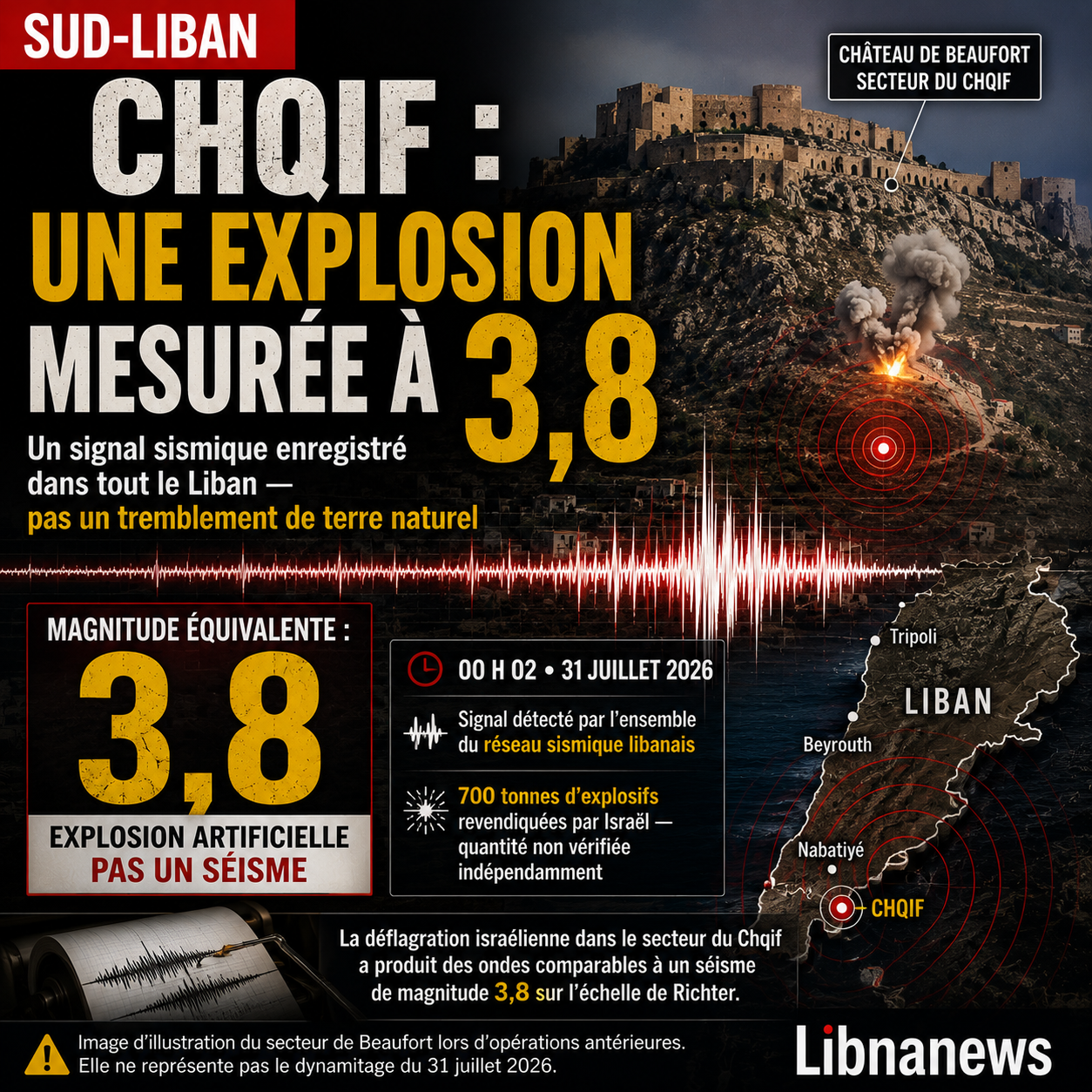
A deflagration carried out by the Israeli army in the Chqif sector in southern Lebanon produced during the night of Thursday to Friday waves recorded by the entire Lebanese seismic network. The National Geophysical Centre, attached to the National Council for Scientific Research, located the signal at 00:02 a.m. on 31 July 2026. He compared it to an earthquake of magnitude 3.8 on the Richter scale. This does not mean that a natural earthquake hit the country. It describes the size of the signal transmitted to the basement by the Chqif explosion. The episode occurs in an area subject to intense military operations and around Beaufort Castle, inscribed a week earlier, with four other fortresses of Mount Amel, to the world heritage and then placed on the World Heritage List at risk.
A deflagration recorded at 00:02
The survey of the public centre provides a precise landmark in a night marked by several explosions in the south of the country. Stations detected soil movements at the same time. Their origin was attributed to blasting in the Chqif region. The centre did not describe a tectonic rupture, nor announced a new natural epicentre. He spoke of « land waves » produced by the explosion and of a signal that could be compared to a magnitude 3.8. This distinction responds to frequent confusion. A high detonation can vibrate rocks, buildings and sensors without causing an earthquake in the geological sense. The devices record a movement. Specialists then determine the source from its time frame, its location and the shape of the waves.
The deflagration was heard far beyond the immediate vicinity of the fortress. Reports from a news agency reported strong vibrations in several locations in Nabatiyah and Marjayoun. The noise was also reported to have spread to more remote areas, including Iqlim al-Kharroub and Khaldé. These testimonies describe the spread of breath in the air and vibrations in the ground. They alone do not measure magnitude. The communiqué of the National Geophysical Centre is based on calibrated instruments. It therefore provides the central technical element: the Lebanese network has identified an artificial event powerful enough to appear on all its stations.
Chqif Explosion: Why 3.8 is not an earthquake
The magnitude measures the size of a seismic source from recorded waves. It does not automatically specify its cause. A sudden slip over a fault, the collapse of a cavity, an industrial explosion or a military blast can all generate a signal. Seismologists then study its characteristics. In this case, the Lebanese scientific authority directly linked the survey to the Israeli operation. The reference to 3.8 thus serves as an instrumental comparison. It does not transform the explosion into a natural earthquake. Nor does it prove that a fault has moved or that a sequence of replicas has begun. At this stage, there is no official public disclosure of a tectonic activity triggered by the operation.
The magnitude scale is logarithmic. An increase in a unit corresponds to an amplitude recorded ten times greater, not a simple arithmetic progression. This property makes intuitive comparisons difficult. It also explains why the 3.8 value must be handled accurately. The figure sums up a signal, but does not say how many windows have broken, how much pressure has reached the houses or in what condition the dynamited galleries are in. The depth of the load, the nature of the rock, the distance of the sensors and the containment of explosives greatly alter the energy transmitted to the ground. Two explosions using an identical mass can produce different recordings.
Magnitude and intensity, two different measurements
The magnitude should not be confused with the intensity felt. The first attribute a value to the event. The second describes the effects observed at a given site. It varies with distance, type of terrain and building resistance. The same source can be strongly felt in a nearby village and almost imperceptible elsewhere. The relief of South Lebanon adds another variable. Ridges, valleys and rock formations influence the passage of waves and breath. The comparison with 3.8 does not mean that all Lebanon has suffered the same shock. It indicates that the instruments have captured a signature across the country that is sufficiently clear to be analysed.
This grade is important for damage assessment. Broken windows or new cracks are found on the ground. Seismograms do not replace the inspection of dwellings, the examination of infrastructure, or the survey of the monument. However, they can set the time of the event to the nearest second and show how energy has spread. Crossed with videos, satellite images and engineering visits, they help reconstruct the operation. In an area where access remains subject to military constraints, this scientific trace is one of the few elements immediately available.
A separate signature in the seismograms
Natural explosions and earthquakes generally do not produce the same wave combination. A detonation exerts sudden pressure around a point or a set of loads. It often generates a marked compressive signal. A tectonic earthquake results mainly from a slip along a fault and produces more shear movements. Specialists compare primary waves, known as P, and secondary waves, known as S. They also study the apparent depth, duration and frequency content of the signal. No isolated criteria are always sufficient, but they often distinguish an explosion from an earthquake.
In the Chqif sector, the known time of blasting provides an additional index. The concordance between the operation, the testimonies and the arrival of the waves on the network reinforces the attribution announced by the center. The detailed publication of the tracks would allow further progress. It would show the arrival times on each station, the maximum amplitude and the differences between the components of the movement. The press release issued on Friday morning did not yet present these raw data. It delivered a synthetic qualification, intended for the public: the ground vibrated under the effect of an explosion, with a signal comparable to that of an event of magnitude 3.8.
The seismic network as an independent witness
The fact that all stations recorded the event does not mean that damage occurred around each of them. Sismometers detect much weaker movements than a person can feel. They are used precisely to capture distant signals and then compare their arrival from one point to another. The more dense and properly synchronized the network, the more accurate the location and characterization. The announcement of the centre shows above all that the deflagration has left a measurable footprint at the national level. It gives the authorities an independent reference to military images and social media stories.
These records can also be used to distinguish several close loads from a single detonation, provided that their spacing is sufficient and the signals do not overlap entirely. The Israeli army described the operation as the destruction of a tunnel network. It did not make public, in its initial announcement, the complete plan of the galleries, the layout of the charges and the technical chronology of the firings. The seismogram can provide clues on the duration and succession of impulses. It does not, however, allow, without other data, to map the destroyed works alone or establish their previous use.
The Israeli 700-ton claim
The Israeli authorities claimed to have used approximately 700 tons of explosives to destroy tunnels under Beaufort Ridge. They attributed these facilities to Hezbollah and presented the operation as a response to a ceasefire violation they attributed to the Lebanese movement. These statements constitute the official Israeli version. They were not accompanied on Friday morning by an independent check on the exact quantity, type or extent of the galleries. The magnitude announced is exceptional. However, it requires careful reading, as the term « 700 tonnes of explosives » does not specify the equivalent of TNT, the method of counting, or the part actually detonated at the same time.
It would therefore be wrong to mechanically convert this figure into magnitude. The chemical quantity is never fully transmitted as seismic waves. Part of the energy breaks the rock, moves materials, heats the gas, produces noise and dissipates in the air. Seismic efficiency depends on containment, gallery geometry, depth, and massif composition. Loads spread over several points do not have the same effect as a concentrated mass. The 3.8 value announced by the centre is a result observed by the sensors. The 700 tons are, for the time being, a claim by a party to the conflict. Both data should not be presented as if one automatically showed the other.
Broken windows and houses to examine
Early local reports reported broken windows and damage to houses in Al-Qlaiaa in the Marjayoun area. Residents described intense vibration and a strong smell of powder. The information available in the morning did not indicate any casualties directly related to the blasting of the Shqif. This balance sheet remained provisional. Access to sectors close to the operation, dispersal of residents and the state of communications may delay the reporting. The municipalities must still distinguish between the damage caused by the air breath, those caused by the movement of the ground and those caused by other strikes carried out during the same night.
The technical priority is to verify fragile structures. Old buildings, already damaged houses and works on cracked floors may have delayed effects. Vibration does not always cause immediate collapse. It can expand an existing crack, move a roofing element, or weaken a poorly countervented wall. Water systems, roads and supports close to cavities also deserve control. A destroyed gallery can create an unstable vacuum or change drainage locally. Only an inspection by engineers and geologists will separate visible damage from the risks that remain hidden.
Beaufort, a fortress now at risk
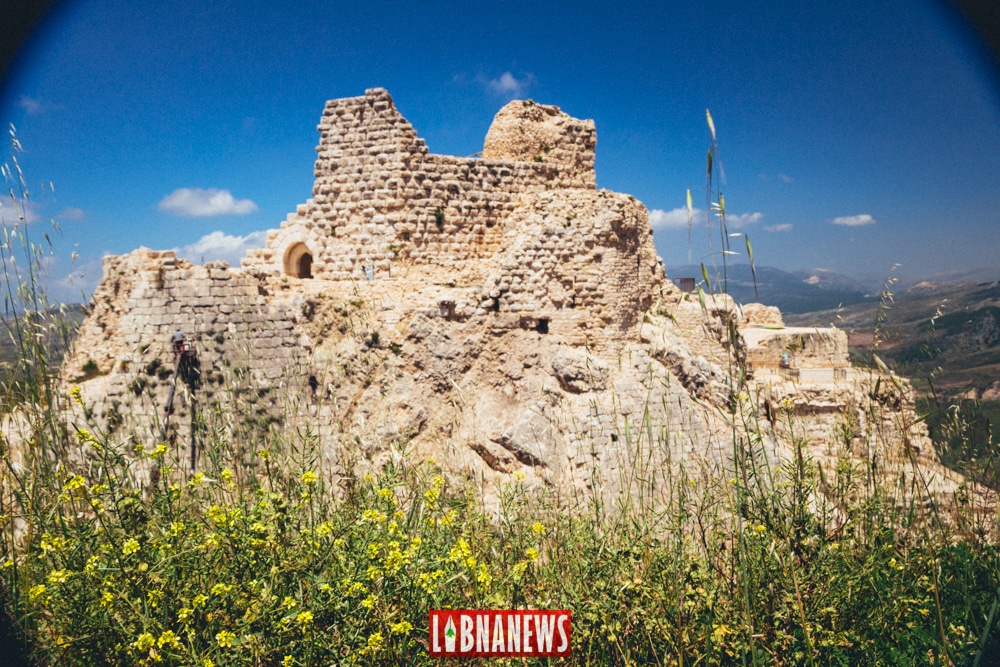
The blasting takes on a particular dimension because of the proximity of Beaufort Castle, called Qalaat al-Shaqif in Lebanon. The fortress dominates the Litani Valley from a rocky promontory. Its position has shaped its military history and heritage value. On July 24, seven days before the explosion, the World Heritage Committee placed the Castles of Mount Amel on the World Heritage List under an urgent procedure. The ensemble includes Beaufort, Tibnine, Chakra, Deir Kifa and Chamaa. It has also been placed on the World Heritage List at risk due to threats related to the conflict.
This recent ranking does not yet measure the consequences of the operation. However, it reinforces the attention paid to the site. Prior to registration, Beaufort already enjoyed provisional enhanced protection under the Hague Convention on Cultural Property in Armed Conflict. By the end of May, the competent international organization had reported reported strikes near the fortress. Lebanese cultural authorities had requested international access and mobilization. The Israeli army had announced at the end of May that it had taken control of the height. These elements place the monument in a space where military presence, protected heritage and claimed underground infrastructure overlap.
No complete independent inventory of night damage was available Friday morning. An explosion under a ridge can affect a monument without immediately leaving a spectacular breach. Old masonries react to vibrations according to their condition, their previous repairs and the quality of the joints. Micro cracks may appear in or around vaults. Blocks can be loosened. The carrying rock itself must be examined if galleries have been destroyed nearby. Photographs taken before and after the operation, three-dimensional surveys and crack controls would provide a stronger basis than just remote observation.
What surveys can establish, and what they don’t know
Seismic data can confirm the schedule, estimate the size of the signal and help locate its source. They can also document an operation whose effects exceed the filmed area. Their interest is scientific, but also administrative and heritage. A timed record can be attached to a damage file, compared to municipal reports or used to plan an inspection. Finally, it can be used to search for possible secondary events in the following hours, such as cavities collapses. These uses require the preservation of raw data, their calibration and transparent analysis by specialists.
The same surveys have clear limits. They do not say who was in the tunnels, what they contained or what their function was. They do not prove the amount of explosives invoked. They do not determine alone whether a conflict law rule has been respected. Nor do they establish the precise state of the castle or neighbouring villages. To answer these questions, the instruments must be crossed with operational documents, images, samples and inspections. This separation between measured fact, military claim and damage not yet assessed remains essential in the treatment of the event.
Monitoring to continue after the shock
The proximity of known faults in southern Lebanon naturally feeds concerns. However, an explosion of magnitude equivalent to 3.8 does not mean that a larger earthquake will follow. Explosions may, in rare circumstances, alter the constraints very close to an already unstable fault. This mechanism is neither automatic nor demonstrated here. The first release did not report any tectonic replicas. However, this lack of reporting is not sufficient to close any surveillance. The national network must continue to examine the posterior signals in order to distinguish possible collapses, new detonations or natural activity unrelated to the operation.
The expected future data are both geophysical and field. The National Geophysical Centre could publish details on the location, amplitudes and shape of the waves. Municipalities must consolidate the survey of affected housing. The competent heritage services will have to access Beaufort with engineers, architects and geologists. A comparison with pre-combat records would help identify new cracks. Until such visits are possible, the 3.8 figure remains the most accurate finding available on the power transmitted to the ground, while the actual extent of damage under the ridge, in the fortress and in neighbouring villages remains to be established.